WGWA
Log your play
iPhone with RetinaiPad with RetinaWherigo Foundation PlayerWhereYouGoGarmin Colorado/OregonEmulatorGeneric Player
|
Walking the Dog.
|
Starting Location Description
A corner of the car park at Brocks Hill Country Park
About This Cartridge
At several points along the route you will need to answer questions and look for information to record which you require to calculate the final co-ordinates , please read each screen befoore setting off for the next location, and scroll down each screen to ensure you don't miss anything important !
The cartridge should auto save at each stage, so you do not have to start all over again from the beginning if you have a problem.
If using a 'phone, beware, don't use auto complete for word answers, just type in each letter, otherwise the word may not be accepted.
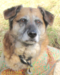
This walk should take less than an hour, and is particularly (but not exclusively) good for caching dogs and the humans on the other ends of their leads. I've had the privilege of caching with a few: Elz' now sadly demised Cassie (arch treat-thief, always a bored sigh and flop when a long cache search was needed, but an enthusiast when water was around). Gladstone8's Biggles, tiny legs a blur to keep pace , (that's Biggles not G8 ... ) . And the new pup literally running rings round Elz, the lovely April. The whole of her is a blur ...
Cartridges In The Area
What Else Is Nearby?
Map Links
Suggested Cartridges
Suggested Cartridges
Looking for more cartridges? What's popular? Those who completed this cartridge also completed these: